The Tests ... cont/dWhile surfing the GPS websites, I found GPSnuts (www.GPSnuts.com) and noticed they had a Canadian section. There I found a review of the Garmin Mapsource Canada maps, and noted the reviewer had found similar inaccuracies with the maps. What was interesting was that he'd used CDAL points to verify road intersection locations. I'd never heard of CDAL but it didn't take Google (www.google.com) long to track it down to a Canadian Government office in Quebec. The bad news was that they had closed their database to the public so I thought I was at a deadend. The good news was that I then tracked down the guy that did the GPSnuts review (would you believe he lives quite near me and is a sponsor of the Kawasaki GPS Trail Ride series!) and he shared his CDAL database points with me.It was interesting finding out how to get these
points in the MapSource and MapSend maps (that's for another report), but
once in there it was amazingly easy to check the map accuracy at almost
any point in Canada. Here's a few examples of typical areas I ride
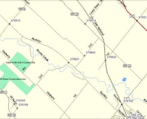
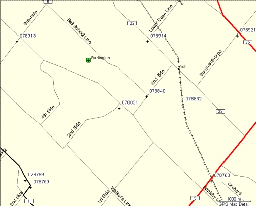
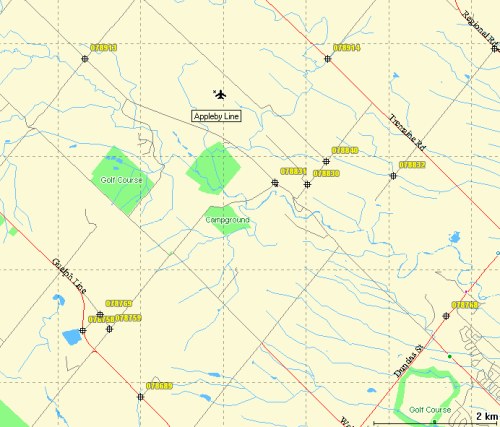
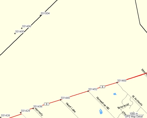
my Dual Sport motorcycle - the Oakville/Milton area, Orangeville, Coe Hill
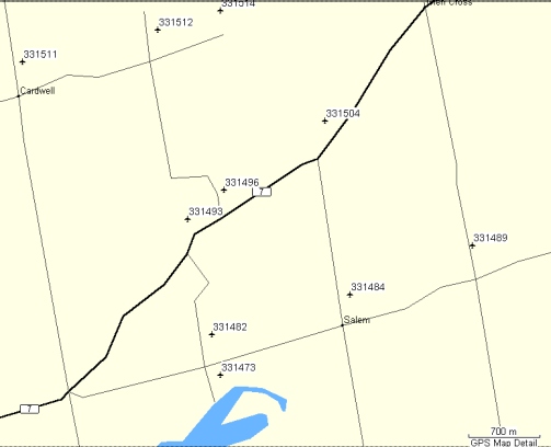
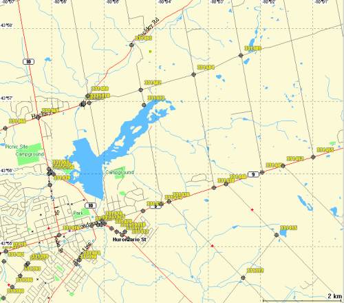
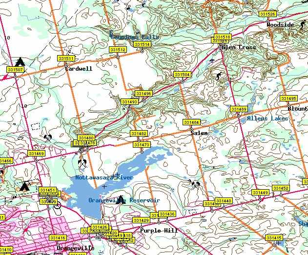
near Bancroft, and the 5 Points area near Bobcaygeon. To interpret
these maps, look at the scale and then notice how far a CDAL point (6 digit
waypoints) are from the intersection of either roads or railtracks.
My observations are:
ConclusionsMy overall conclusion is that the EBM is not suitable for Dual Sport motorcycle route planning, but would be fine for finding your position if you were lost. The MapSend maps would be my choice. Unfortunately, the choice of maps is not usually relevent if you already own a GPS. In my case, I selected the Garmin eTrex based on user experience and without knowing the relative merits of each brand of mapping software. The Garmin maps will suffice for approximate position checks on the GPS screen, but I doubt they will be usable for detailed routes I need to create on my PC..For planning organized rides, where it may
not always be possible to pre-ride the route, I expect to only use Topo
maps. SoftMap Topo50, with the GPS plug-in, seems the easiest to
use at this stage. I haven't used OziExplorer enough to know if there
are any shortcuts, but I find it frustrating that it only handles one small
map at a time, whereas, SoftMap has all of Ontario in a seemless single
map (almost, apart from the White Hole near Bancroft!).
|