The Tests
Let me say immediately ... I am not qualified
to discuss this subject! I've had a GPS since Dec 25, 2002, I've
read the manuals, I've visited every GPS site I can find on the Internet,
and I've logged hundreds of hours playing with these devices and with a
whole load of GPS software on my PC. Having said that, I'll report
my findings and the reader can perhaps benefit from my experience, but
don't make any important decisions based on what you read here. Also, if
anyone who really knows anything about GPS systems finds this report, please
let me know of any boo-boos!
My initial plan was no more complex than take
both GPS with me whenever I went any reasonable distance and let them run
in the tracking mode. I would then compare the tracks with the respective
maps and note any discrepancies. This would have been OK for local
roads but we are in the grips of a typical Canadian winter and I haven't
been able to cover much distance. The results of the initial "tracking
trips" can be seen in these screen shots.
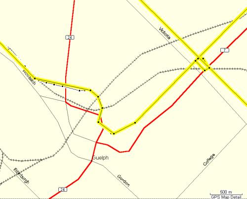 |
This shows a trip through Guelph using the Garmin Mapsource Canadian
Enhanced Base Map (EBM). We came into town travelling SW on Hwy 7 and our
track (yellow) is at least 300m away from the road (the little detour around
Victoria and 7 was when we spotted a Tim Horton's!). Our return,
SE on Victoria, overlaps our previous track, so the GPS is doing it's job
in reporting our position. |
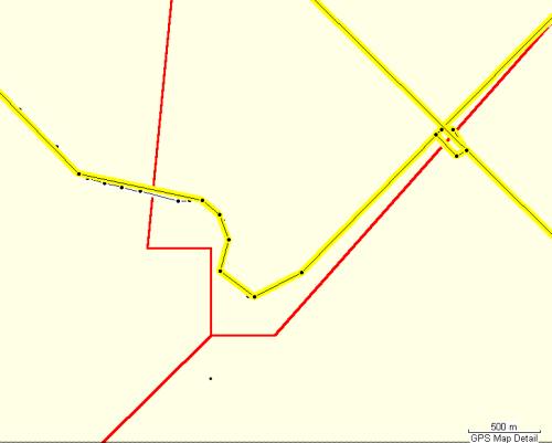 |
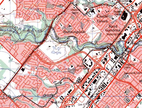
This shot is the same area as above, and it illustrates 2 important
points.
The Garmin Mapsource Canadian Metroguide (MG) map is useless outside
of the 4 major urban areas - it doesn't even identify the city as Guelph!
The other point is that it's accuracy is pretty awful. |
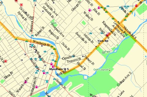 |
Magellan MapSend Streets & Destinations Canada (SD) map showing
the same route in Guelph. Apart from the totally different level of detail,
the track follows the road precisely. |
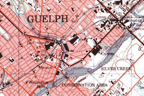 |
The Guelph track shown on the SoftMap Topo50 GPS map - quite accurate.
However, you cannot upload this map to a GPS, but you can use it to prepare
the route waypoints. |
 |
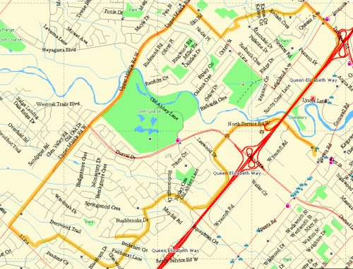
This illustrates the strength of the MG map. In the Toronto urban area
it is very accurate and contains a wealth of information. The GPS
tracks accurately follow the roads, and the maps are quite up-to-date,
many of the streets shown here were only built in the last few years. |
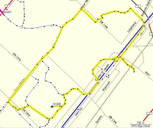 |
Back to the EBM for the same region as above.
First you notice the lack of roads, and then you notice the errors
from about 100m to 300m.
Also the data is VERY old - 4th Line hasn't gone straight from Lakeshore
to Upper Middle Rd for about 20 years! |
 |
The Magellan SD map has high detail and accuracy. A possible
downside to this is the large amount of memory that must be required to
upload these maps to the GPS. There may be a way to suppress the
amount of detail uploaded, but I haven't found it yet. |
 |
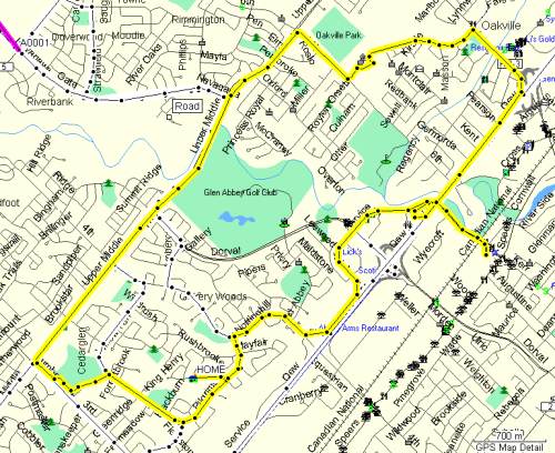
The Glen Abbey, Oakville track on the Topo50 GPS map. Excellent
corelation between the track points and the map. |
|